
When it comes to construction and landscaping projects, having an accurate measurement of slope is crucial. A laser level can be a valuable tool in determining the slope of an area, whether you are looking to install a patio, build a retaining wall, or even put up a fence. With its ability to emit a straight and level beam of light, a laser level can help you easily figure out the slope of any surface.
The first step in figuring out slope with a laser level is to set up the instrument correctly. Make sure the device is securely positioned on a tripod and leveled. This will ensure that the laser beam emitted by the level is accurate and reliable. Once the laser level is set up, you can start measuring the slope of the desired surface.
Next, position the laser level at one end of the surface you want to measure. Turn on the laser and allow it to emit a straight beam of light across the surface. Ensure that the laser beam is visible and easily distinguishable. Be cautious of any obstructions or obstacles that may interfere with the laser beam and affect the accuracy of your measurement.
Now, move to the other end of the surface and take another measurement. Pay attention to where the laser beam hits the surface. By comparing the two measurements, you can determine the slope of the surface. If the laser beam hits the surface at the same height in both measurements, it means the surface is level. However, if the laser beam hits lower or higher in the second measurement, it indicates a slope.
Calculating the slope can be done by measuring the vertical distance between the two laser beam points and dividing it by the horizontal distance between the two measurement points. This will give you the slope ratio. You can then express this ratio as a percentage or a fraction, depending on your preference. By following these steps and using a laser level, you can easily and accurately figure out the slope of any surface for your construction or landscaping project.
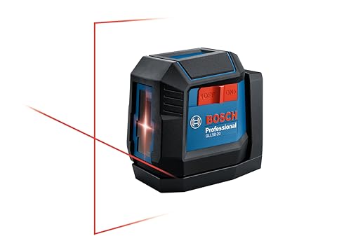
Choosing the Right Laser Level
When it comes to figuring slope with a laser level, choosing the right tool is essential for accurate and efficient results. There are a few key factors to consider when selecting a laser level for your project.
Type of Laser Level
There are different types of laser levels available, including line laser levels and rotary laser levels. Line laser levels are suitable for basic slope measurements and alignment tasks, while rotary laser levels offer more advanced features like automatic leveling and dual-axis slopes. Consider the specific requirements of your project to determine which type of laser level is most suitable.
Accuracy and Range
The accuracy and range of a laser level are crucial for getting precise slope measurements. Look for a laser level with a high level of accuracy, typically expressed in terms of millimeters per meter. Additionally, consider the working range of the laser level to ensure it can cover the distance required for your project.
Battery Life and Durability
Another important factor to consider is the battery life and durability of the laser level. Depending on the complexity and duration of your project, you will want a laser level with a battery that can last throughout the job. Additionally, consider the durability of the laser level to ensure it can withstand any rugged conditions or accidental drops that may occur.
Additional Features
Lastly, consider any additional features that may be useful for your specific project. Some laser levels offer features like self-leveling, remote control operation, or compatibility with digital slope measurement tools. Assess your project requirements and choose a laser level with the necessary features to make your job easier and more efficient.
In conclusion, choosing the right laser level is crucial for accurately figuring slope. Consider the type, accuracy and range, battery life and durability, and additional features when selecting a laser level for your project. By choosing the right tool, you can ensure accurate measurements and efficient workflow.
Setting Up the Laser Level
Before you can begin using a laser level to figure slope, you need to properly set it up. Follow these steps to ensure accurate results:
1. Choose a Suitable Location
Find a flat and stable surface where you can place the laser level. This could be a table, tripod, or any other sturdy support. Make sure the surface is level and free from any obstructions that could interfere with the laser beam.
2. Mount the Laser Level
Attach the laser level firmly to the chosen support using the mounting mechanism provided. Ensure that it is securely fixed to prevent any movement during operation.
3. Check the Bubble Level
Most laser levels come with a built-in bubble level indicator. Use this indicator to make sure that the laser level itself is perfectly level. Adjust the position of the level until the bubble is centered to ensure accuracy.
4. Power On the Laser Level
Once the laser level is securely mounted and level, power it on using the designated power button or switch. Check the manufacturer’s instructions for specific details on powering and calibrating your laser level.
5. Adjust the Slope Settings
Depending on the model of your laser level, you may need to adjust the slope settings. Some laser levels have a manual adjustment knob or button, while others may require you to input specific measurements or select slope options on a digital display. Follow the manufacturer’s guidelines to properly set the desired slope on your laser level.
6. Set the Laser Level at a Reference Point
Select a reference point where you want to measure the slope. This could be the starting or ending point of a surface or an object. Position the laser level at this reference point, ensuring that the laser beam aligns with the desired slope direction.
7. Measure the Slope
Using a measuring device such as a ruler or tape measure, take measurements at various points along the laser beam path to determine the slope. Record these measurements for future reference or calculations.
By following these steps, you can effectively set up your laser level and begin figuring out slope measurements with accuracy and ease.
Measuring Slope Using the Laser Level
When it comes to measuring slope, a laser level is an invaluable tool. It allows you to accurately determine the angle of incline or decline on a surface, making it especially useful for construction, landscaping, and surveying projects.
Step 1: Set up the Laser Level
Start by setting up your laser level on a tripod or any stable surface. Ensure that it is positioned at the desired height and aligned with the area you want to measure the slope of.
Step 2: Align the Laser Level
Once the laser level is set up, make sure it’s properly aligned. Use the bubble level or built-in leveling feature to ensure that it’s perfectly horizontal. This will ensure accurate slope measurements.
Step 3: Measure Reference Points
Identify two reference points on the surface whose slope you want to measure. These points can be anything from two stakes in the ground to existing structures. Measure the vertical distance between these two points using a tape measure.
Step 4: Calculate the Slope
To calculate the slope, divide the vertical distance between the two reference points by the horizontal distance between them. This will give you the tangent of the angle, which represents the slope.
Slope = vertical distance / horizontal distance
For example, if the vertical distance is 4 feet and the horizontal distance is 10 feet, the slope would be 4/10 or 0.4.
Step 5: Convert the Slope to a Percentage or Degrees
Depending on your requirements, you may need to convert the slope to a percentage or degrees. To convert slope to a percentage, multiply it by 100. To convert slope to degrees, use the inverse tangent function.
Note: The conversion formulas may vary depending on the specific laser level or software you’re using. Always consult the user manual or instructions provided by the manufacturer for accurate conversions.
By following these steps, you can easily measure slope using a laser level. Remember to double-check your measurements and take necessary precautions to ensure safety during the process.
Interpreting Slope Measurements
When using a laser level to measure slope, it is important to understand how to interpret the measurements accurately. Slope measurements are typically expressed as a ratio or a percentage, representing the change in elevation over a given horizontal distance.
Ratio
In ratio form, slope measurements are expressed as a comparison of the vertical change to the horizontal distance. For example, a slope of 1:4 means that for every 1 unit of vertical change, there is 4 units of horizontal distance. This indicates a relatively gentle slope.
A steeper slope might be represented by a ratio such as 1:2, meaning that for every 1 unit of vertical change, there is only 2 units of horizontal distance. On the other hand, a shallower slope could be represented by a ratio like 1:10, where there is 10 units of horizontal distance for every 1 unit of vertical change.
Percentage
An alternative way to express slope measurements is as a percentage. This is often used in civil engineering and construction projects. The percentage represents the vertical change as a proportion of the horizontal distance, multiplied by 100. For example, a slope of 25% means that there is a 25 unit vertical change for every 100 units of horizontal distance.
A steeper slope would have a higher percentage, such as 50% or even 100%. A shallower slope would have a lower percentage, such as 5% or 10%.
Interpreting Laser Level Readings
When using a laser level to measure slope, it is crucial to carefully read and understand the displayed measurements. Keep in mind that the laser level will provide instant and accurate readings, eliminating the need for manual calculations.
Make sure to reference the manufacturer’s instructions to understand how the specific laser level model represents slope measurements. Some models may display ratios, while others may display percentages. Understanding how the readings are displayed will help ensure accurate interpretation.
Additionally, it is important to calibrate the laser level properly before use to ensure accurate measurements. Any errors in calibration can lead to inaccurate slope readings.
By correctly interpreting the slope measurements provided by a laser level and ensuring proper calibration, you can effectively use this tool to assess and manipulate slopes in various applications.
Applications of Slope Measurements
Measuring slope using a laser level is a useful technique that has applications in various industries and fields. Here are a few examples of how slope measurements can be applied:
1. Construction and Civil Engineering
- Site Preparation: Slope measurements are essential for preparing construction sites, ensuring proper grading for foundations, roads, and drainage systems.
- Earthwork: Slope measurements help in calculating the volume of material needed for earthwork projects like excavations, embankments, and land grading.
- Roads and Highways: Slope measurements play a crucial role in road and highway design, ensuring safe and efficient drainage, and preventing water pooling.
- Landscaping: Slope measurements are used in landscaping projects to create aesthetically pleasing and functional outdoor spaces.
2. Agriculture and Irrigation
- Terracing: Slope measurements are utilized in terracing agricultural fields to prevent erosion and optimize water and nutrient distribution.
- Irrigation Systems: Slope measurements help determine the gradient for irrigation systems, ensuring proper water flow and distribution to crops.
- Drainage: Slope measurements are critical for designing effective drainage systems in agricultural areas, preventing waterlogging and promoting crop health.
3. Surveying and Mapping
- Topographic Surveys: Slope measurements are frequently used in topographic surveys to accurately represent the terrain’s elevations and gradients.
- Geographic Information Systems (GIS): Slope measurements are essential for creating accurate digital elevation models and conducting spatial analysis.
These are just a few examples of the many applications of slope measurements in various fields. The accuracy and ease of using a laser level for slope measurements make it an indispensable tool for professionals in these industries.